Find the property
Boundaries, ownership facts and individual map layers help orient the conversation.
Preliminary land due diligence
Enter an address and describe the plan. Landery checks the home, septic area, well, driveway and accessory buildings together against parcel data, mapped constraints and local requirements.
Private beta · Selected Kent County, Michigan jurisdictions · Preliminary screening, never a permit decision
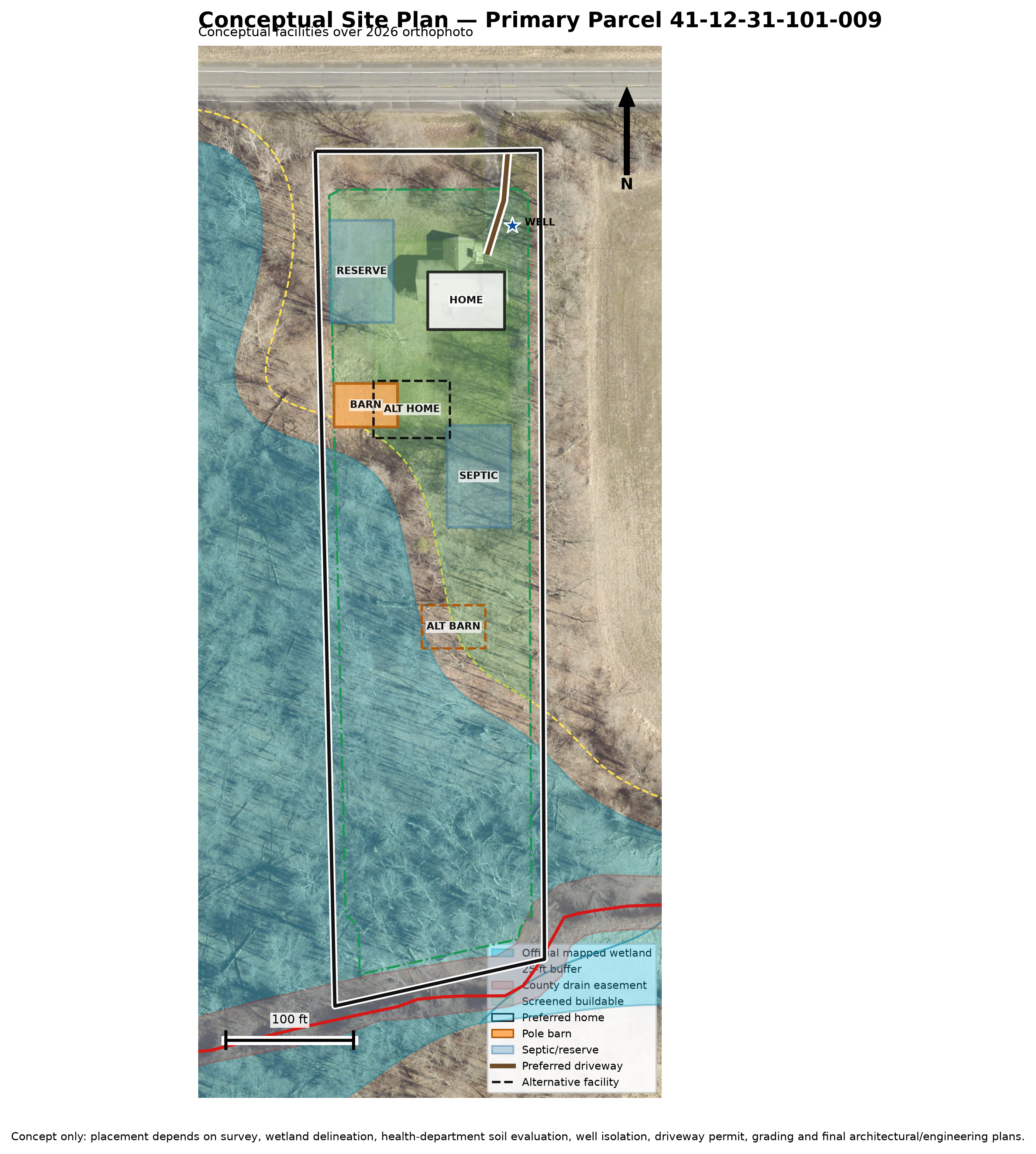 Illustrative sample · official evidence and conceptual features use different symbols
See the answer, the evidence and the uncertainty
A map shows what is there. Landery helps explain what it may mean for this property and this specific plan.
Built for the decision—not the layer count
Landery carries the question further while staying honest about what public evidence cannot decide.
Boundaries, ownership facts and individual map layers help orient the conversation.
A score may flag concern, but it rarely shows whether the requested home, septic system and access fit together.
Test the requested home, septic reserve, well, barn and access at realistic dimensions, then show what must be verified next.
What a realtor receives
A plain-language preliminary conclusion, confidence and the most important next move.
Realistically sized home, septic reserve, well, accessory building, yard and access concepts where evidence supports them.
A dated checklist of the township rules and confirmations that control the proposed plan.
Wetlands, soils, flood hazard, terrain, access dependencies and hidden-cost questions before commitment.
A detailed PDF, map images, measurements, sources, retrieval dates and explicit limitations.
A clearer first conversation
Designed for the moment before a client spends thousands on surveys, engineering and specialist work.
Select adjoining parcels and verify the decision unit visually.
Size the home, barn, yard, septic, well, drive and expansion needs.
Review layouts, conflicts, uncertainty and hidden-cost exposure without forcing a favorable answer.
Use the interactive report, detailed PDF, maps, measurements and dated source record.
Founding beta
Planned post-beta pricing begins at $29 per completed property analysis. Billing is not active, and the detailed pricing hypothesis may change as we learn from testers.
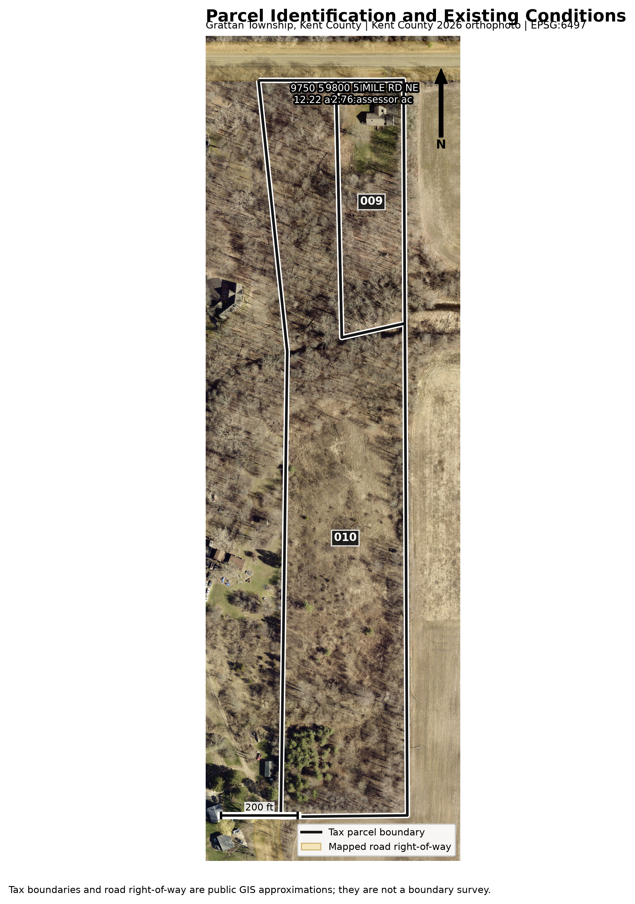
Answer first. Evidence always.
Every conclusion carries confidence, source age and explicit limitations. Official data, derived measurements and conceptual ideas remain clearly distinguished.
Private founding beta
Landery is currently testing the complete automated workflow with two invited Kent County real-estate professionals. Broader access is not yet available.
Analysis timing depends on property complexity, source availability and automated validation checks. Beta testers will see clear processing and blocked-analysis states.
Questions: marketanalyst.data@gmail.com
Invitation only
Use the email address that received your Landery invitation. Your private workspace includes five automated analyses for 30 days.
Sign in to LanderyHave a question or want to be considered for a future test?marketanalyst.data@gmail.comFrequently asked questions
No. It provides a preliminary opportunity, material-constraints or insufficient-data conclusion and identifies professional and agency confirmation still required.
County parcel and imagery services, supported local zoning sources, Michigan EGLE, FEMA, USDA NRCS, USFWS and USGS. Each report records sources and retrieval dates.
Landery does not force a homesite. It explains the limiting evidence, lowers confidence where appropriate and recommends the smallest next verification step.
No. They are planning possibilities only. Title, ownership, road-agency, engineering and local approvals control.